Big Bend Protection Alliance · A registered 501(c)(3) nonprofit
CBP has paused construction in Big Bend
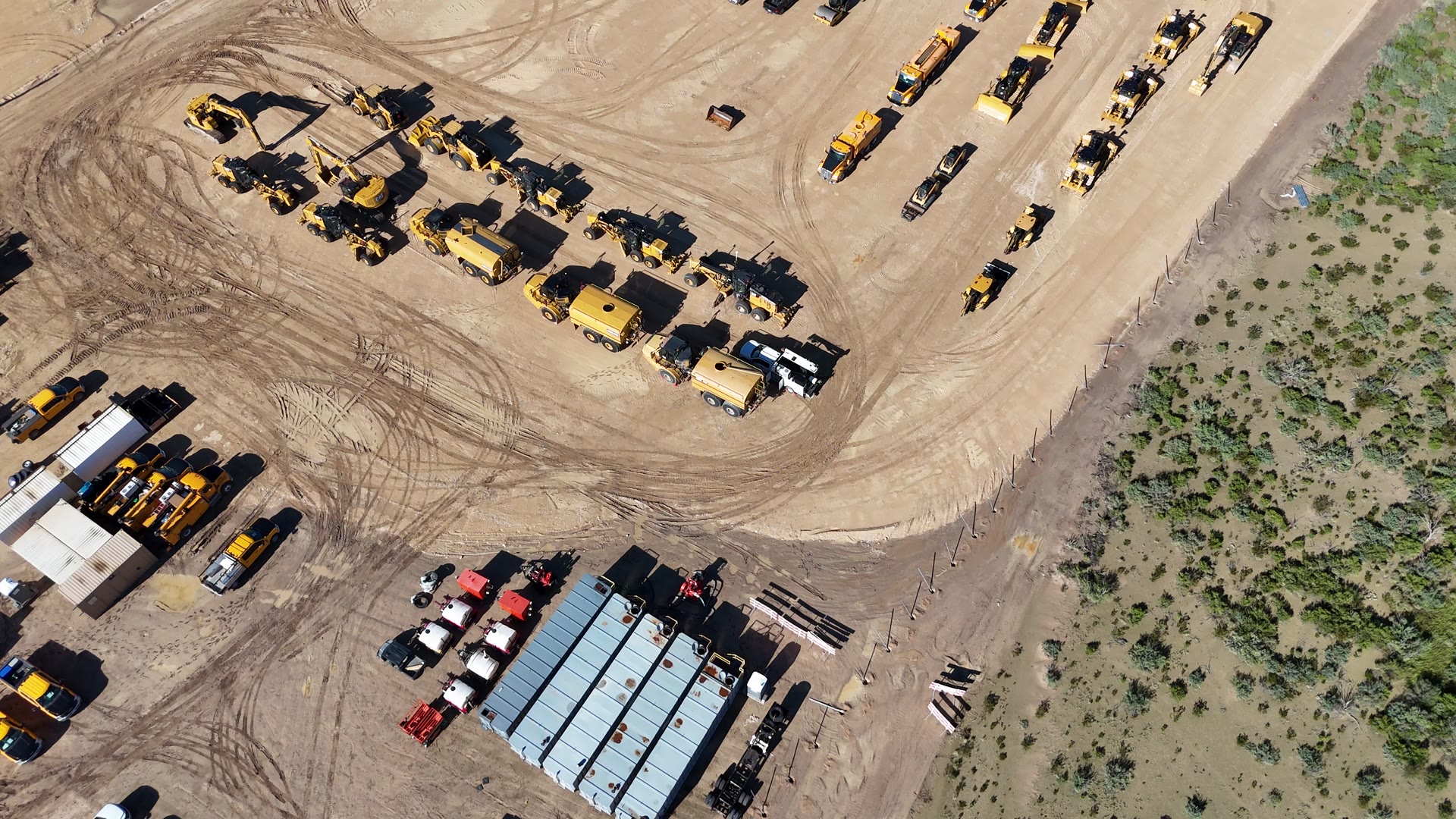
On August 17, the Commissioner of U.S. Customs and Border Protection paused all construction activity in Big Bend National Park during a personal, on the ground evaluation. The pause came four days after contractors began bulldozing at the mouth of Santa Elena Canyon, shown here. A pause is not a cancellation. This is public land that belongs to every American, and we are documenting what happens next.
See where it's happening · See the updated wall map
Donations are tax deductible. EIN 41-4611124. Verify our tax status. Hotline answered 24/7 at (432) 248-0002.
Field footage · August 13, 2026
Stay up to date
Field updates and news from the Big Bend region, as it happens.
Prefer the feed? We post there too.
What we work on
The Alliance protects the ecological and cultural integrity of the Big Bend region through education, monitoring, and public awareness. These are our current projects.
Documentary Film
We support an independent film documenting the current state of the Big Bend: its land, its people, and the changes underway in one of the most remote corners of the country.
Read moreDark Sky Monitoring
We are collaborating with the region's dark-sky community, McDonald Observatory, and Big Bend National Park to expand night-sky monitoring with more advanced and more numerous cameras and sensors, so changes to some of the darkest skies in North America are measured and shared.
Read moreResearch & Education
Sourced research on the landscape, wildlife, and infrastructure changes in the region. Everything we publish is traceable to government records, court filings, and federal contract data.
Read moreField Update · August 5, 2026 · Brewster County, Texas
The bulldozers are inside the park.
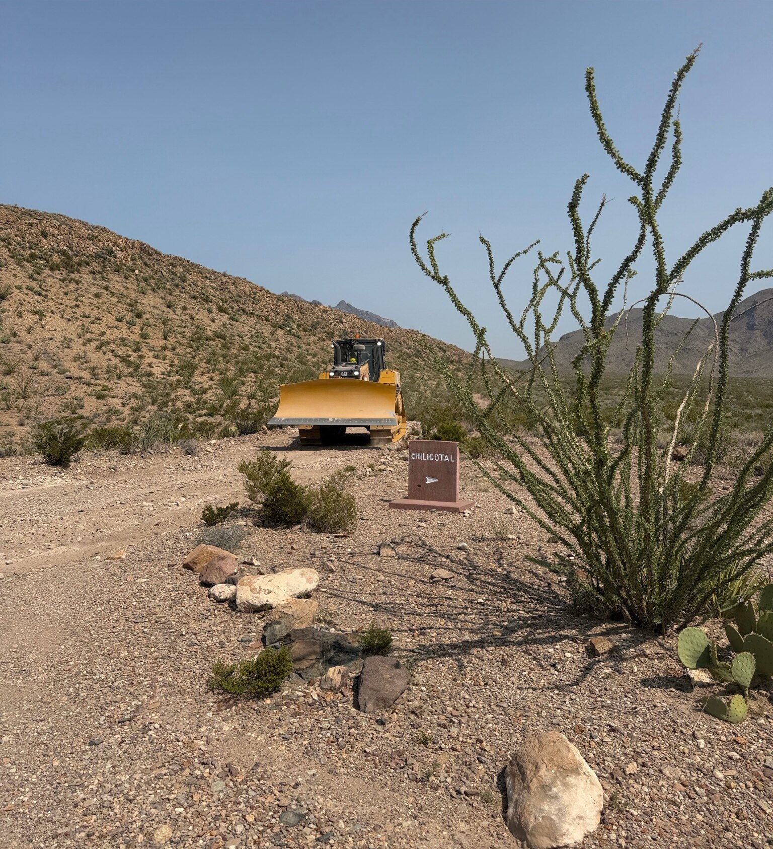
The sign marks a campsite. The machine is cutting road.
Chilicotal, Big Bend National Park · 5 August 2026
Used with permission. Photographer anonymous by request. Cropped from the original.
On Tuesday, August 4, heavy equipment belonging to Southwest Valley Constructors, the Kiewit subsidiary holding a $1.7 billion federal border contract, moved into Big Bend National Park. The following day, crews began cutting new road.
The machine above was photographed on August 5 at 11:30 a.m. at the Chilicotal campsite marker off Glenn Spring Road. The original capture carried GPS coordinates, cropped from the version shown here. They put it 29°14′18″N 103°10′12″W, plotted on the map here. This is not near the park. It is in it.
Customs and Border Protection says the crews are “re-grading roads that were damaged by recent storms” and that the work is required for access to conduct surveys. The contract those crews are working under covers roughly 200 miles of patrol road up to 24 feet wide, vehicle barriers, and surveillance towers, including a crossing at Mariscal Mountain, which rises 1,700 feet above the Rio Grande.
A separate order, one county west
Five days earlier, on July 31, Texas Land Commissioner Dawn Buckingham ordered federal contractors off state land in Presidio County. A General Land Office cease-and-desist went to CBP and to Barnard Construction after more than a mile of state land was cleared without written consent.
“Texas sovereignty will not be infringed upon by failure to follow established protocol.”
That order is a different contractor on different land, and it does not reach the national park. We are not going to tell you it stopped what is happening at Chilicotal, because it did not. What the two have in common is the pattern: ground cleared first, permission sorted out afterward.
Full background on the segments, contractors, and what has been confirmed versus reversed: Texas Observer · our sources
Tap the pin, or see the footage on Instagram
Seen equipment in the field? Send us photos with location and time.
The research behind our work
Everything we publish is traceable to government records, court filings, and federal contract data. Start wherever you like.
The Impact
What the proposed construction would mean for wildlife corridors, the Rio Grande watershed, and some of the darkest night skies in the country.
Read moreThe Map
Where the proposed segments fall across the Big Bend region, and what sits in their path.
Read moreThe Record
A dated timeline of what has been proposed, waived, contracted, and changed, with the underlying sources.
Read moreAbout the Alliance
The Big Bend Protection Alliance (BBPA) is a registered 501(c)(3) nonprofit organization (EIN 41-4611124) incorporated in Texas. The Alliance coordinates regional conservation groups, cultural heritage organizations, and community members working together to protect the ecological and cultural integrity of the Big Bend region through education and public awareness.
Big Bend National Park is one of America's most remote and ecologically significant national parks, home to over 1,200 plant species, 450 bird species, and some of the darkest skies in North America. Research indicates that proposed infrastructure may bisect critical wildlife corridors, disrupt the Rio Grande watershed, and permanently alter the landscape of Santa Elena Canyon and the Chisos Mountains.
BBPA supports conservation education through research, public awareness, environmental monitoring, and community engagement. All contributions support the Alliance's mission and project work, keeping Big Bend wild, open, and protected for future generations: federal public land held in trust for every American, not just Texans. Donations are tax-deductible to the fullest extent allowed by law.